Super El Niño Keeps Growing as New Forecasts Reach Record Territory Ahead Winter
Super El Niño 2026: Rapid Growth and Record-Breaking Forecasts
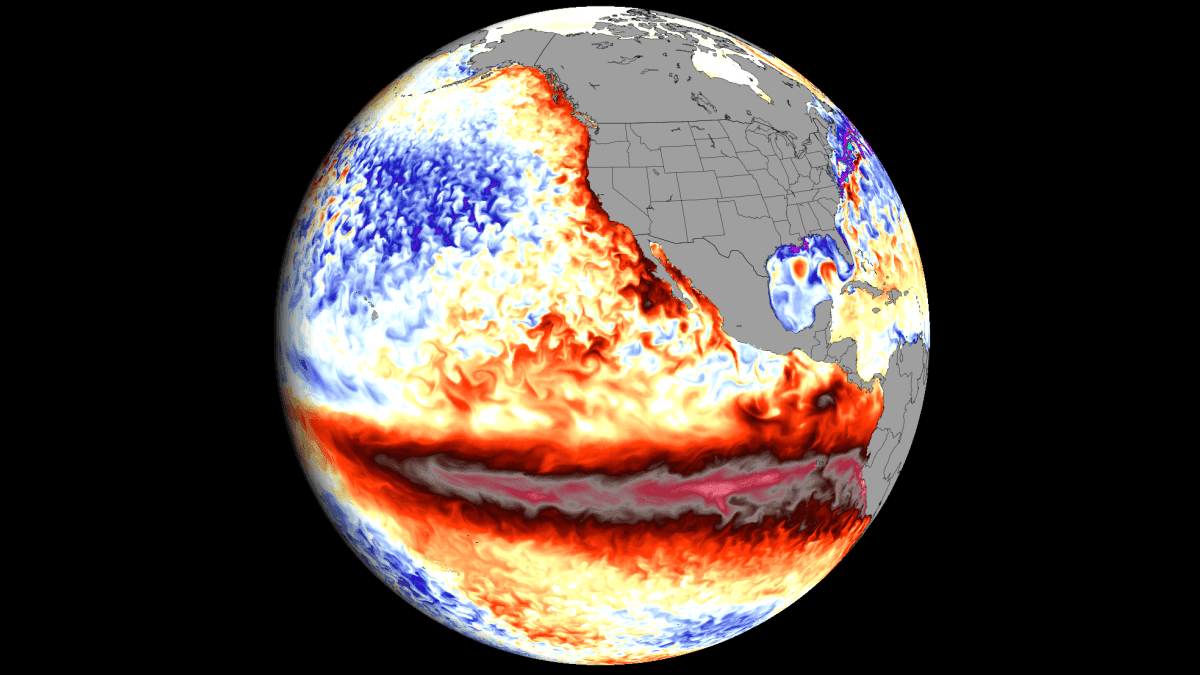
The tropical Pacific is currently witnessing a rapid intensification of a Super El Niño. Fresh atmospheric and oceanic data indicate that the event is accelerating, with updated long-range projections pushing the 2026 peak into unprecedented historic territory as we approach the winter season.
This explosive growth is being fueled by a potent synergy between subsurface oceanic heat and anomalous westerly winds. Specifically, record-level westerly wind anomalies are occurring across the equatorial Pacific, while a massive Kelvin Wave is migrating eastward beneath the surface, pumping warm water toward the surface to power this "Super" event.
Analysis Focus: This report examines the ocean/atmospheric data driving this growth, the shifting long-range forecasts, and the resulting implications for the Fall and Winter 2026/2027 seasons across Europe, Canada, and the United States.
🌀 Super El Niño Dynamics: Reshaping Global Circulation
We have been monitoring this Super El Niño as it evolves into a primary driver of global weather for the 2026/2027 cycle. Because the projected peak strength is constantly being revised upward, continuous monitoring is essential.
The Walker Cell Shift
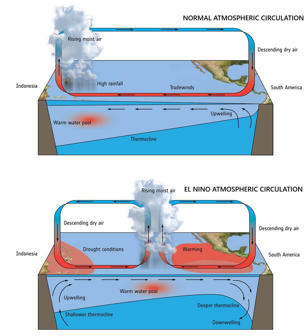
At the heart of this event is the Walker Cell—the loop of atmospheric circulation in the tropics. Strong ENSO (El Niño-Southern Oscillation) events drastically alter this cell.
The process works as follows:
- Pressure Drop: A low-pressure zone develops in the central and eastern tropical Pacific.
- Pressure Rise: A high-pressure zone establishes itself over the western Pacific.
- Global Ripple Effect: This shift alters wind patterns, rainfall distribution, and overall seasonal weather systems worldwide.
Moderate vs. Extreme Impacts
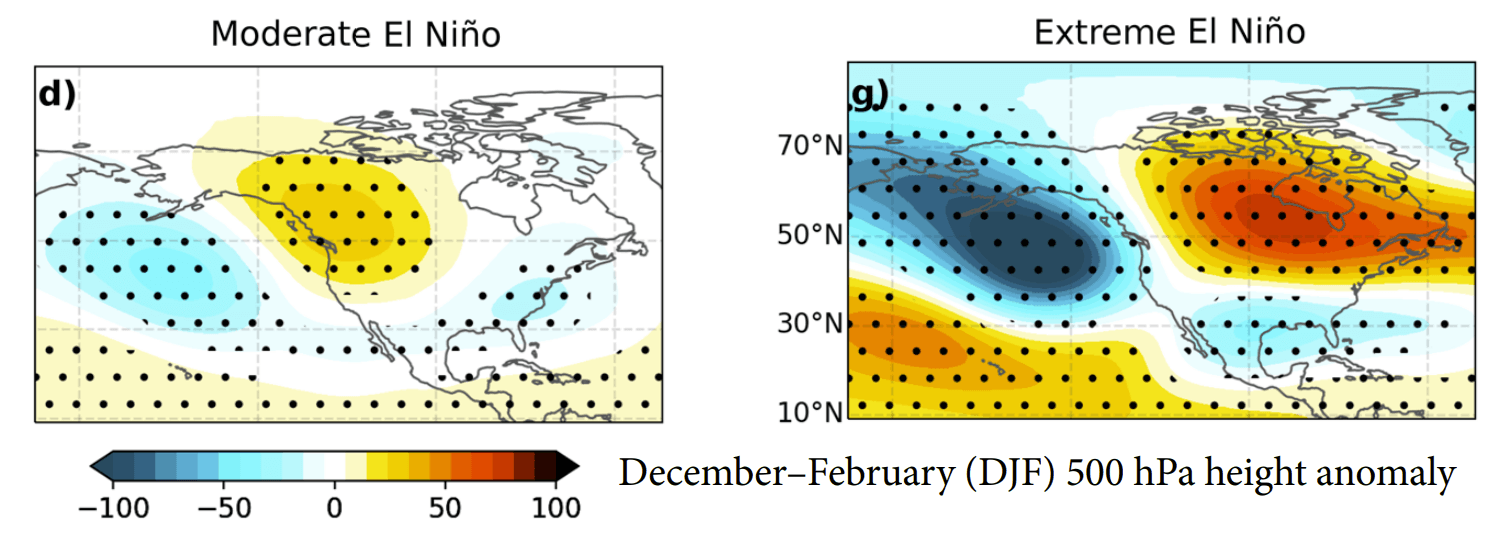
While a standard El Niño creates a mild wave pattern, a Super El Niño triggers a much more aggressive reconfiguration of the jet stream.
| Feature | Moderate El Niño | Super El Niño |
|---|---|---|
| Jet Stream | Mild wave pattern | Aggressive shift / "Atmospheric Highway" |
| Pacific Trough | Shallow | Deep |
| Canadian Ridge | Weak/Moderate | Strong |
| US Weather | Variable | Milder North / Active Southern Storm Track |
Moderate conditions Extreme conditions are now the expected baseline for this event.
🌊 The Kelvin Wave: The Subsurface Engine
The true power of the 2026/2027 event is hidden beneath the waves. A Kelvin Wave occurs when westerly wind bursts pile up warm water in the western Pacific, creating a deep layer of heat that spreads east and eventually surfaces.
Current Data Observations
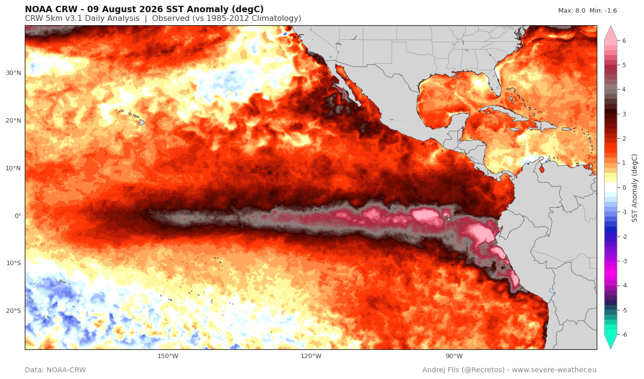
According to the latest NOAA CRW ocean analysis, the ENSO region is saturated with warm anomalies:
- Surface Peaks: Large areas are more than above normal, with some peaks exceeding .
- Growth Rate: The 30-day temperature anomaly change shows a broad warming trend of across a vast area.
- Trajectory: With at least three months of development remaining, the growth is accelerating.
Historical Comparison
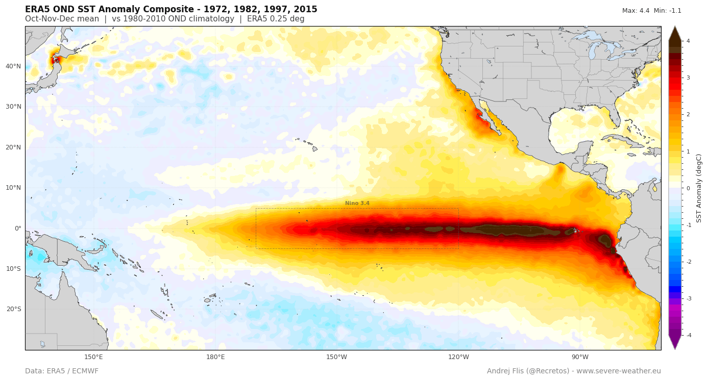
Using the relative ENSO index to normalize data across decades, the 2026 event is showing a development cycle that is among the fastest in history.
- Vs. 2015-2016: The current event has already surpassed the 2015-2016 Super El Niño in terms of both speed and strength.
- Current Status: It is rapidly approaching the peak strength of previous record-breaking events.
🌡️ Subsurface Heat Analysis
The surface anomalies are merely the "footprint" of a much larger energy source. Analysis of the top (approx. ) of the ocean reveals a massive downwelling Kelvin Wave.
Key Subsurface Metric:
This subsurface core acts as a continuous fuel supply, ensuring that as warm water surfaces, the Super El Niño continues to strengthen.
Summary Checklist of Current Trends:
- Record-level westerly wind anomalies detected.
- Subsurface Kelvin Wave moving eastward.
- Surface anomalies exceeding .
- 2026 growth rate surpassing 2015-2016 levels.
- Peak strength reached (Expected later this year).